Fires Tear Through Nebraska Grasslands


February 28, 2026
March 29, 2026
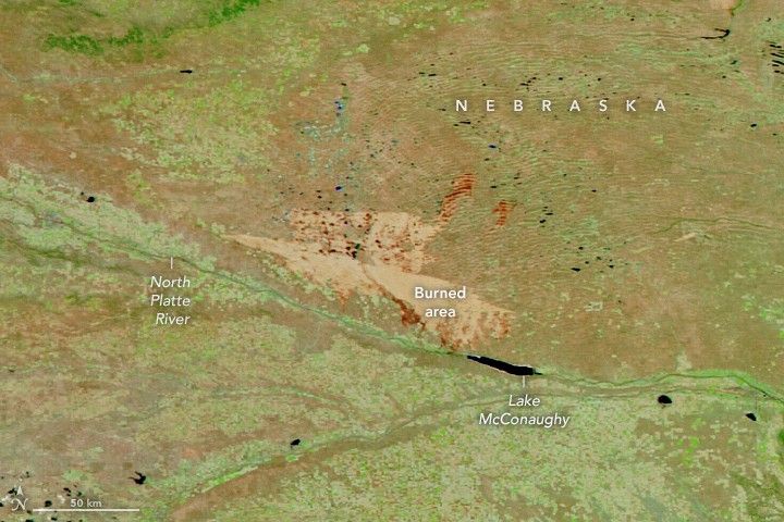
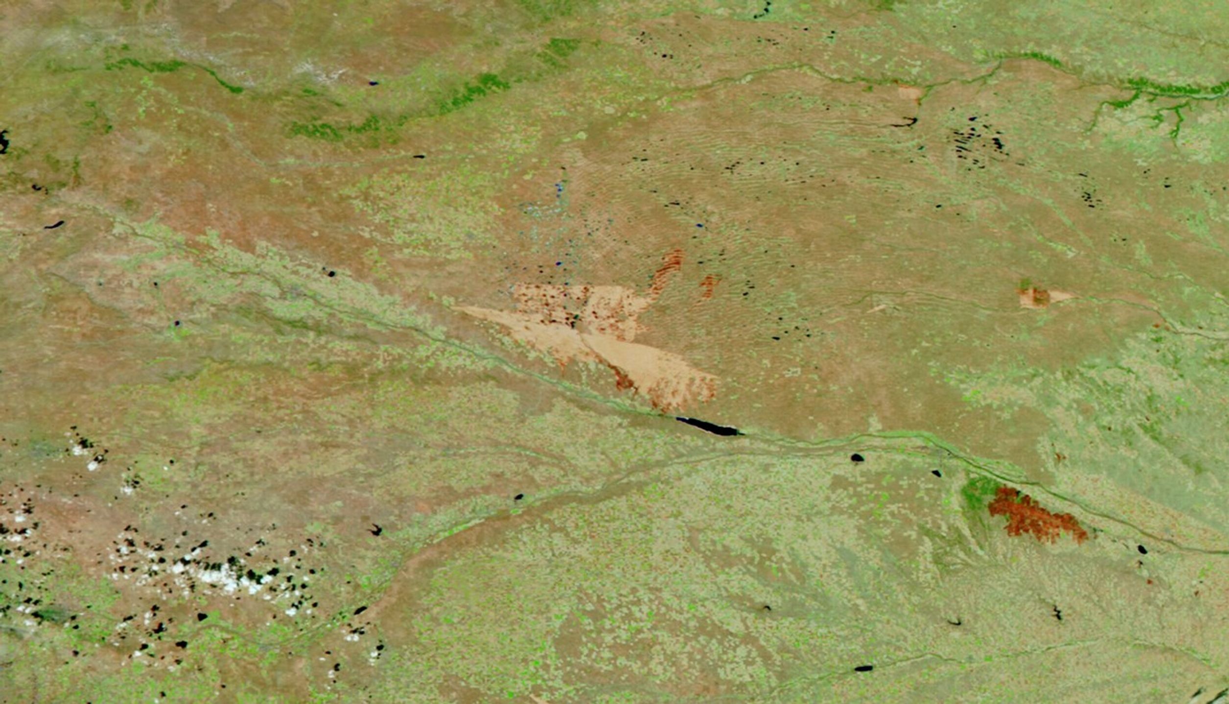
On the afternoon of March 12, 2026, a wildland fire ignited in Morrill County, Nebraska. Within 12 hours, high winds had propelled flames approximately 70 miles (110 kilometers) east-southeast across the prairie. The Morrill fire would burn over 640,000 acres (260,000 hectares) within a week, becoming the largest wildfire in the state’s history.
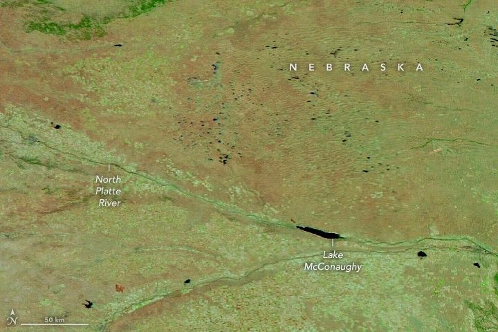
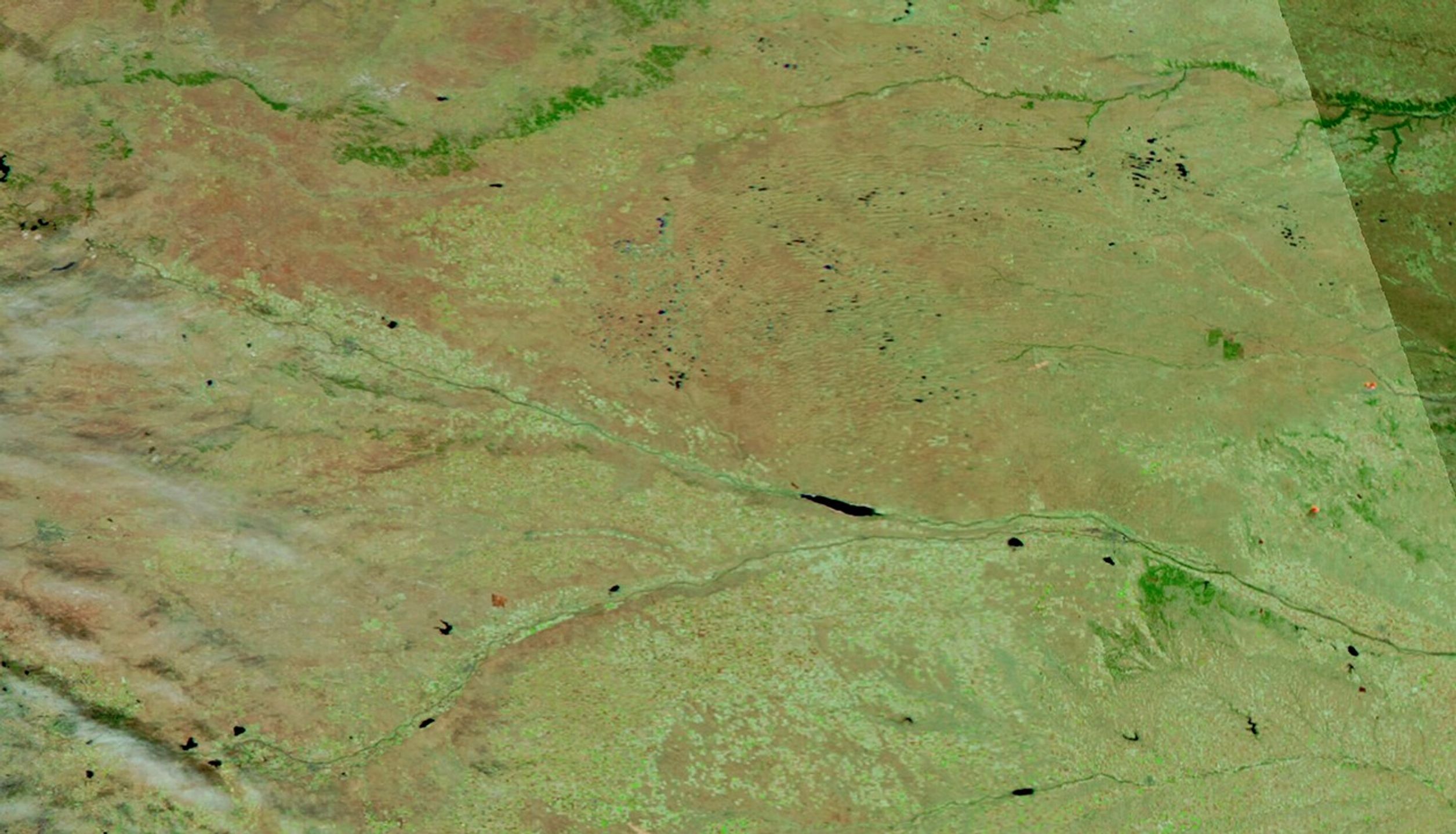
This image (right) shows the extent of recently burned areas near the North Platte River in western Nebraska on March 29. By this time, authorities reported the Morrill fire was 100 percent contained. However, crews were working to contain two smaller blazes immediately to the northeast, the Ashby and Minor fires, which ignited early on March 26. For comparison, the left image was acquired on February 28, before the fires. Both are false-color to better distinguish the burned areas.
The fires occurred amid an active start for wildfires in the U.S. in 2026. The National Interagency Fire Center (NIFC) reported that 15,436 fires had burned 1,510,973 acres nationwide as of March 27. That’s far higher than the 10-year average—9,195 fires burning 664,792 acres—for the same period.
The Great Plains have been particularly prone to fire in early 2026. Exceptionally dry fuels contributed to rapid fire growth and other unusual fire behavior for the time of year, according to the NIFC. Throughout the winter, much of the region saw warmer and windier-than-average conditions, as well as less than 50 percent of average precipitation over a 90-day period, leading to low soil moisture and grass fuels that were primed to burn.
The fires in western Nebraska affected large areas of ranch and pasture lands, destroyed homes, barns, and fences, and injured or killed livestock, according to news reports. The Morrill fire also burned much of the Crescent Lake National Wildlife Refuge in the Nebraska Sandhills, an area of grasslands, wetlands, and dunes used by migratory birds. Despite the fires, reports indicate that hundreds of thousands of sandhill cranes are still making their annual migration through the Platte River valley.
NASA Earth Observatory images by Lauren Dauphin, using VIIRS data from NASA EOSDIS LANCE, GIBS/Worldview, and the Joint Polar Satellite System (JPSS). Story by Lindsey Doermann.
References & Resources
- InciWeb (2026) Morrill Fire. Accessed March 30, 2026.
- National Interagency Fire Center (2026, March 27) National Fire News. Accessed March 30, 2026.
- National Interagency Fire Center (2026, March 20) Fuels and Fire Behavior Advisory: Northern and Central Great Plains. Accessed March 30, 2026.
- Nebraska Public Media (2026, March 30) ‘It’s like a death’: Grief, hope and resilience after fire ravages Nebraska Sandhills. Accessed March 30, 2026.
- The Washington Post (2026, March 24) Wildfires rip through unusual parts of U.S., raising fears of a brutal season. Accessed March 30, 2026.
You may also be interested in:
Stay up-to-date with the latest content from NASA as we explore the universe and discover more about our home planet.

The National fire has burned tens of thousands of acres within the Florida preserve, fueled by vegetation dried by prolonged…

Satellite-based maps show northern wildland fires becoming more frequent and widespread as temperatures rise and lightning reaches higher latitudes.

Dry, gusty conditions spurred fast-growing fires in Oklahoma and Kansas, along with dangerous dust storms across the region.